
In February 2017, we spent a couple of weeks in the Aurina Valley (Ahrntal) in South Tyrol snowshoeing and cross-country skiing in the area. One memorable snowshoeing (winter hiking) trip was the trail to the peak of Eggespitz (2187 m). Though it may evoke thoughts of an omelette, “egg” actually means “peak” in Swiss-German. Eggespitz, and the Aurina Valley where it’s located, lie in the Südtyrol/Alto Adige region in Italy, a beautiful region with a rich and complex history.
THE AURINA VALLEY IN SOUTH TYROL
The region of South Tyrol itself as well as all places bear names both in German and in Italian. The local population mostly traces its origin to a Germanic/Austrian heritage, with a small proportion of the inhabitants being native Ladin speakers, an old Romance language consisting of a few dialects. (Ladin itself being a very rare language, spoken by only about 40,000 people nowadays).
south tyrol snowshoeing
You can easily find a good map with information on how to find the trailhead to Eggespitz at the site of the Aurina Valley. The official information indicates the route as “moderately” difficult, and it takes approximately 1.5-2 hours for an ascend of about 800 metres. Note: Although the peak seemed relatively easily accessible even in winter (in fact, it probably makes for a much easier hike in the summer), never be tempted to assume that the area is safe from avalanches, and always check local conditions and the forecast before you set out in the mountains; stay alert and aware of your surroundings.
A SOUTH TYROL SNOWSHOEING STORY
On a frosty morning in early February last year, after a leisurely late breakfast, we drove out to the village of Lappach. Also called by its Italian name, Lappago, the village sprawls slightly pell-mell in the wrinkles of the narrow valley. Our goal, however, lay further ahead (and up). Steered by our helpful Tom Tom GPS, we took to what seemed like a very questionable road.
The slender winding strip of half-ploughed asphalt kept us on our toes, visible as it was for only a few metres ahead of us, before disappearing – worryingly – behind just one more bend. With every new bend more challenging to maneuver around, and the distance to the village of Lappach below acquiring dizzying depth, we began having doubts about the reasonableness of continuing forward. It was only the notion of sunk costs – the day half gone, the clouds rushing more and more frequently across the sky – that we pushed through, while willing our goal – the Rangers’ Hut (Bergmeister-Alm/malga) – to materialise behind every new bend.
Amazingly, the map we’d consulted promised a fully functioning 2-lane road where we were now driving on this vertiginous asphalt strip flanked by nicely iced slides. I tried not to imagine what we’d have to do to pass a car heading down our way, if it came to that.
It turned out that the list of now evidently misguided expectations we’d harboured included the official parking spot at the trailhead. According to the map, it was to be found a couple hundred metres uphill from the Rangers’ hut. As the hut swung into view after an especially twisty bend, we gingerly drove on, checking constantly with our GPS to locate the parking.
Easier said than done, with snow piled high everywhere. The cleared strip of the road almost vanished as we drove past the hut on the lookout for the parking. Sure enough, there it was, a wide clearing on the right side of the road, with a proper “P” parking sign nearby. Against our best hopes, deep snow was covering the parking and the road onwards. Change of plans.
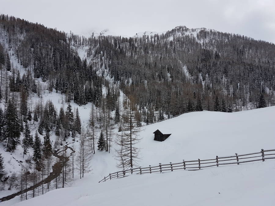
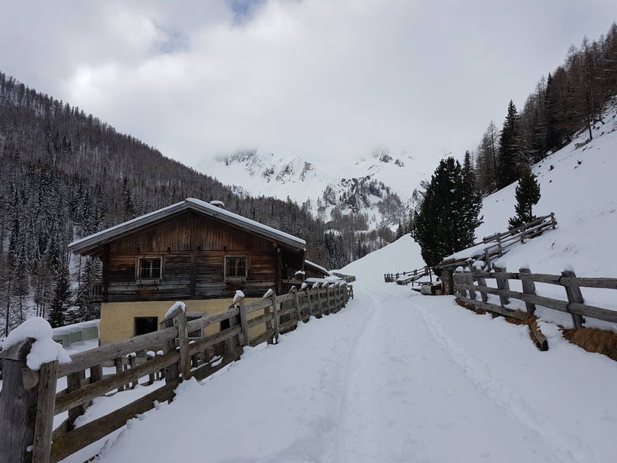
We decided to (carefully) reverse up the slippery road, and on to the steep slope next to the hut. By then, we were not sure anymore on whose property we had parked. So to be on the safe side, we thought we’d score points as customers (and feeling quite exhausted from the treacherous drive), we headed into the hut for a hot espresso.
THE MOUNTAIN RANGERS’ HUT
Pine wood panels covered both the outside and inside of the hut completely. Up a few outside stairs, we reached the entrance and got greeted by a long cold corridor with identical wooden doors along the sides. The first door on the right seemed the most inviting, sporting a small hand-written sign saying “Stübe” or some such jovial place.
Upon entering, the room opened up to the left and in front of us. A few small wooden tables stood nearest to the door, and a bar in the bottom left corner. Next to the bar, the room connected to another open room that we quickly identified as the kitchen (by the sounds and smells coming from there). A billow of warm cheesy smell was streaming from the kitchen, in preparation for lunch. Welcoming the warmth, we plopped on one of the small doily-layered tables, and asked the lady at the bar for coffee.
We had hardly started sipping, when a bunch of three or four mountain rangers joined us in the little room for lunch, having just skiied back from some job in the area. The lady served them thick soup whose concentrated cheese aroma swirled around in the air, almost as viscous as actual fondue stuff.
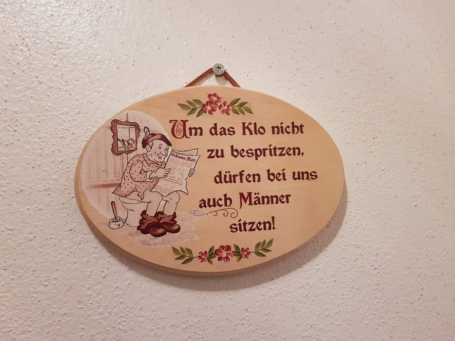
The sight of lunching people precipitated a hesitation on our part about whether to order some of this untasted soup for lunch ourselves. Our sense of duty to the trail we had planned for prevailed, and we decided instead to head out and get on with some snowshoeing. A quick toilet break and a queer snapshot of the restroom facilities’ instructions later, we started out on the the trail (it begins from the official parking place we had attempted to use earlier).
THE TRAIL
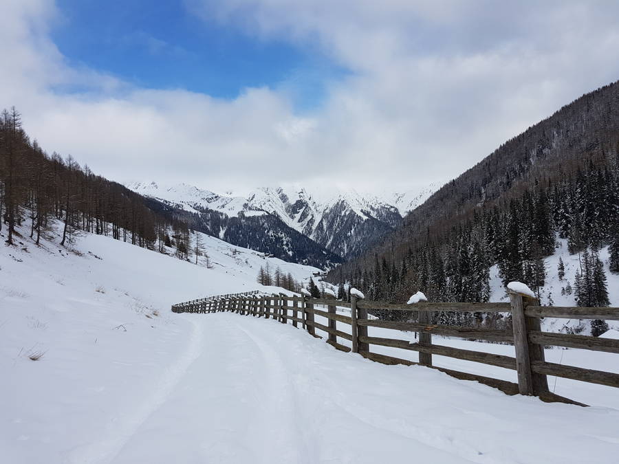
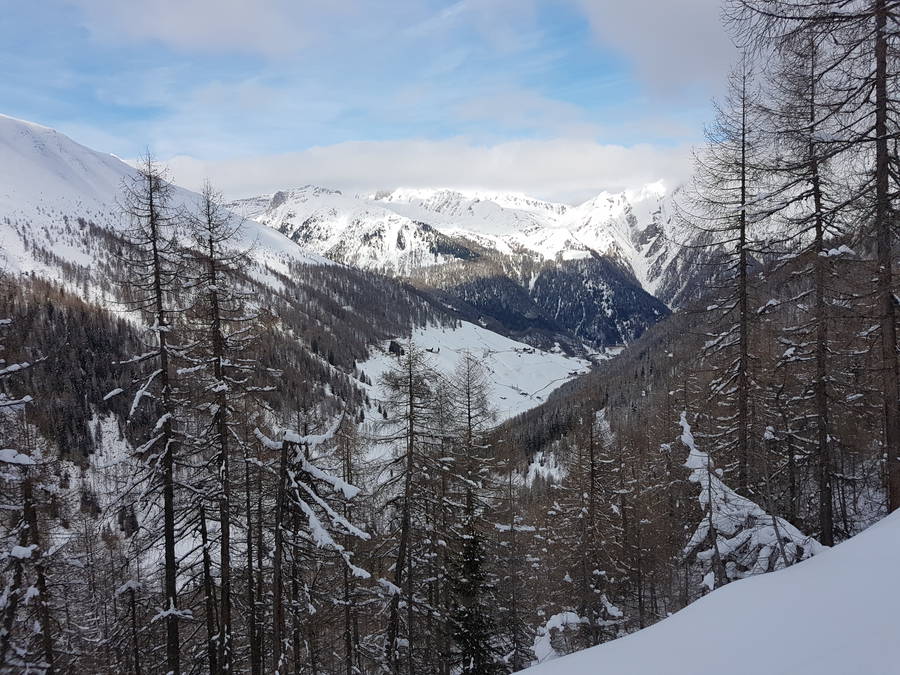
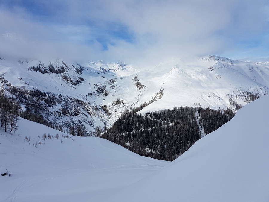
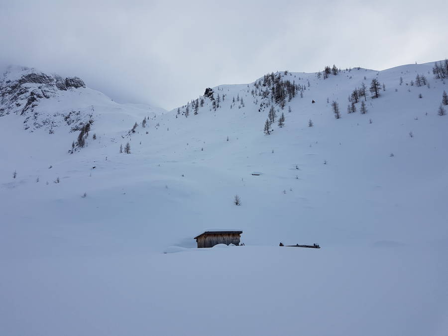
The hut sits at around 1600 metres altitude, and the trail gently slopes up along a river on the left-hand side, on a road that in summer must be a royally-broad dirt road perfect for cycling. After about a kilometre and passing over a small bridge, we reached the end of the valley. Standing as we were at the bottom, we could register tall giants of peaks towering on all sides.
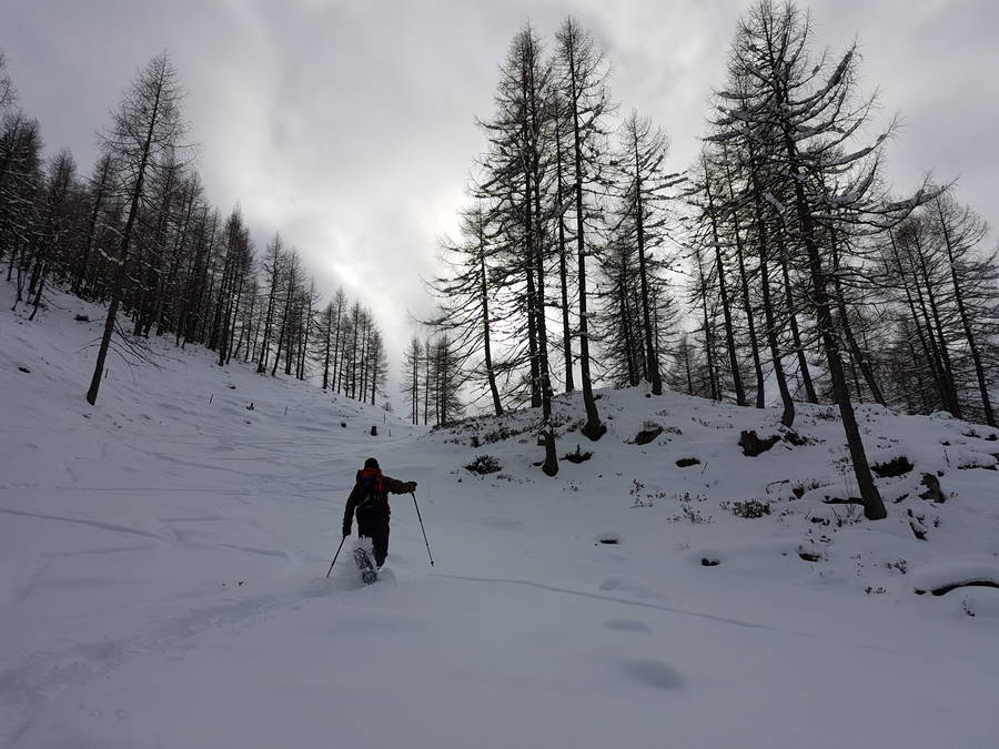
We circled an animal enclosure (for horses or cows), swerved left, and roamed a bit until we found the best way up a short and intense slope. Our snowshoes tangling and scrambling in the deep snow (still untraced by any other human), we trampled a sort of crumbly path in the powdery snow. It was satisfying and made our calves and quads burn like crazy.
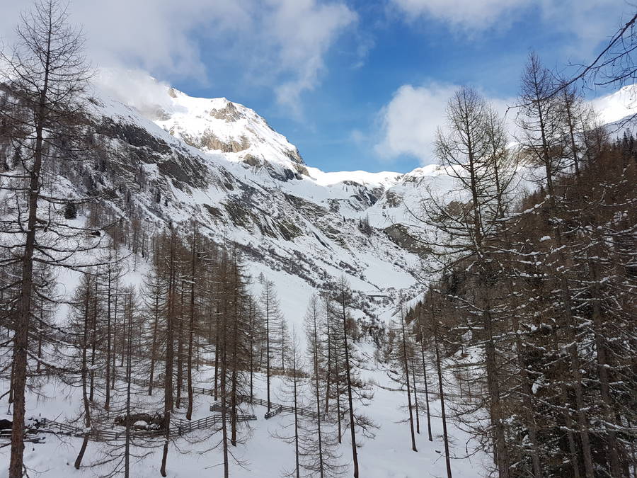
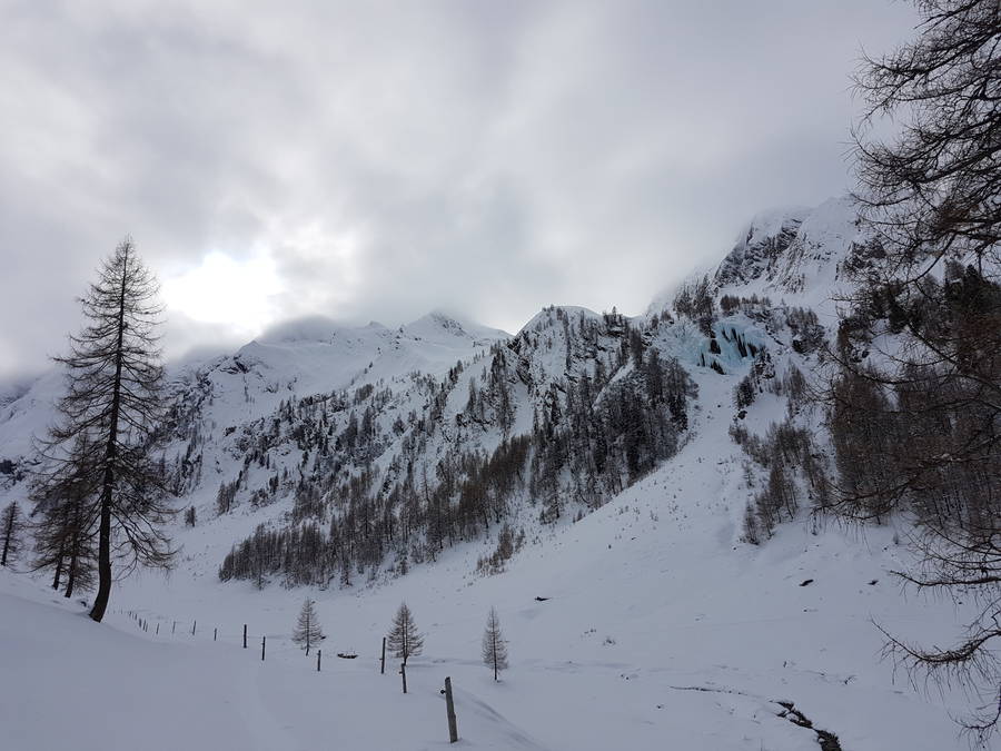
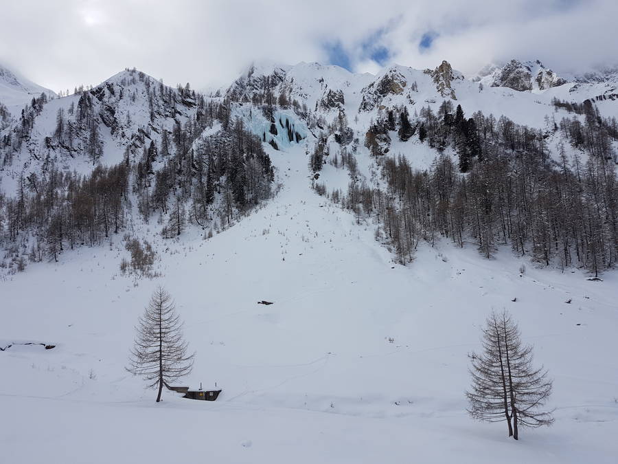
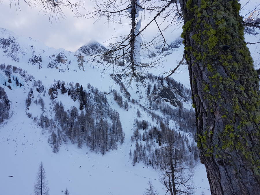
Soon we turned left again, following the right angle curve of our valley (previously, we had not reach the valley’s end after all). On we went in a belaboured snowshoe pace, until suddenly we came face-to-face with a giant frozen waterfall, on the distant rocky wall opposite us – the Zösen Eisfall. Sparkling dimly with a crystal blue, peppered with patches of recent snow, and dissected by the contours of sharp rock, the frozen mass towered awe-inspiring, as if out of a fairy tale.
SNOWSHOEING UP AND UP
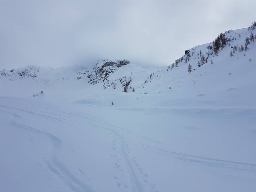
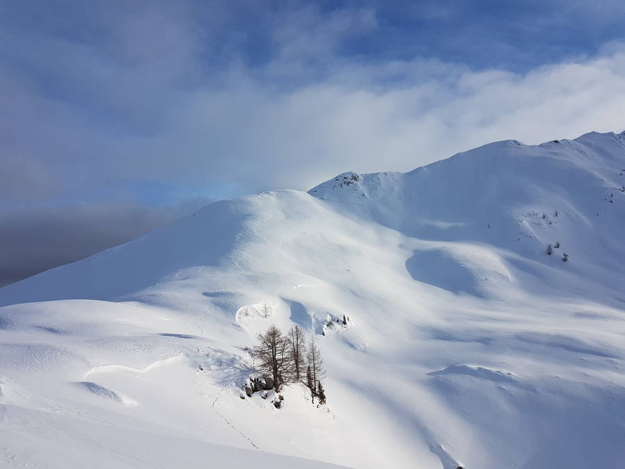
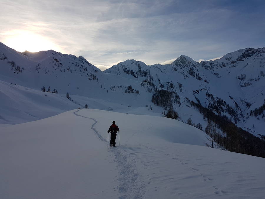
Clouds started drifting more and more frequently in the sky as time sped on in the wintry afternoon. We hurried up in serpentines up the ridge facing the waterfall. What was in summer a dirt road that must comfortably allow for a car, if not even heavier machines, had in winter dwindled to barely a path. The puffy fresh snow forced us to take turns in stomping a path forward. Yet the ground bore plenty of evidence of a lonely skier or two (the rangers?) who had chosen a faster way than us, at least downhill.
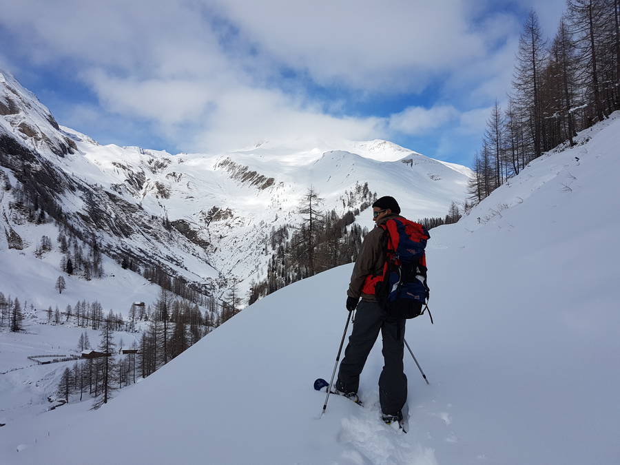
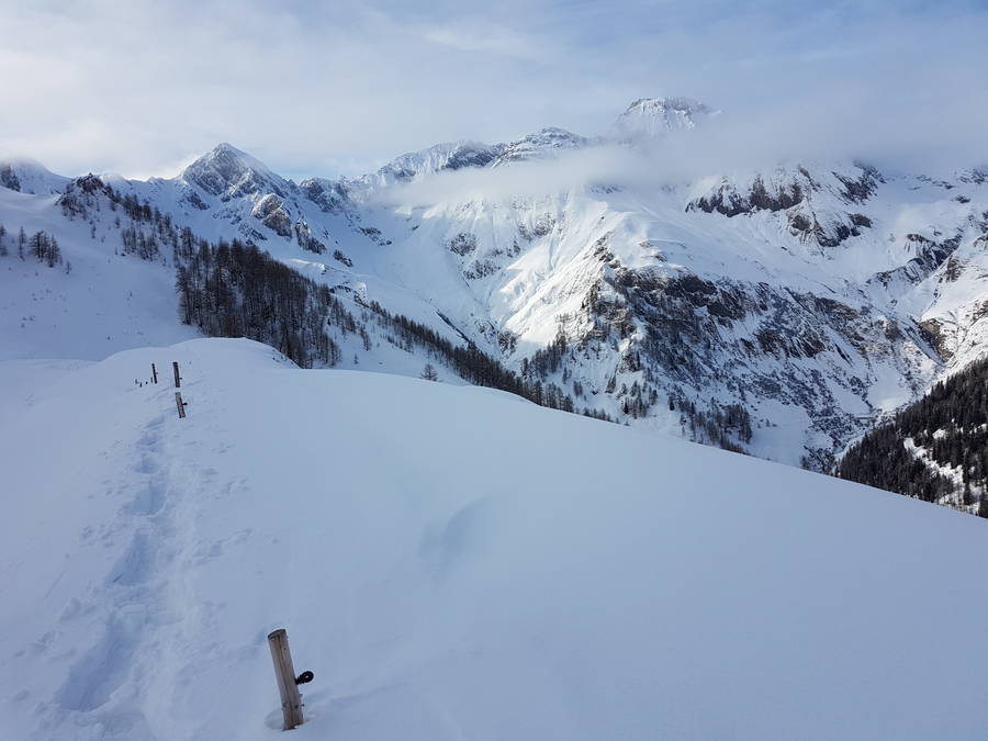
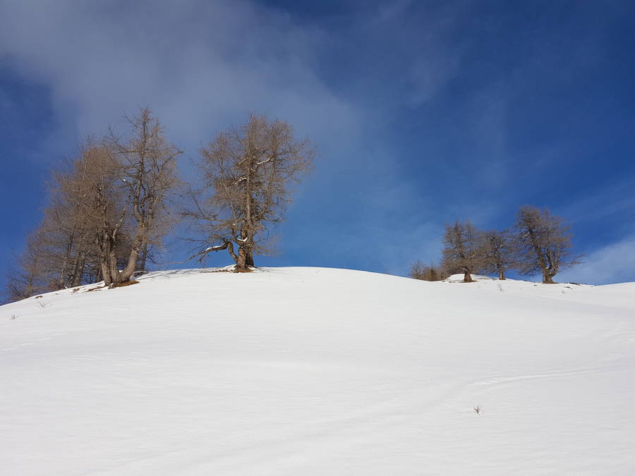
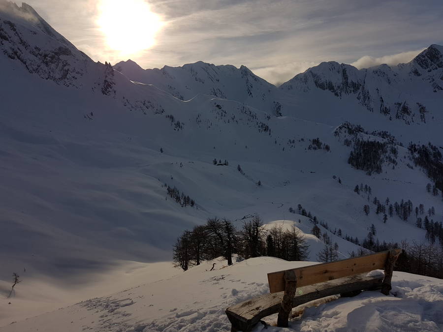
A hazy multi-coloured halo circled the sun as its blob goaded us on; we couldn’t help but keep track of time meticulously. The views were getting ever better as we ascended to 2000 metres. The last serpentine behind us, we emerged on a broad plateau, a high valley flanked by a wall of ragged peaks on the right side. In front of us the wall terminated into a mellow mound of a peak – the Eggespitz, all 2187 metres of it. A tiny frozen stream weaved its way through this snow-blasted valley, to provide the most subtle texture for my largely white-outed photos.
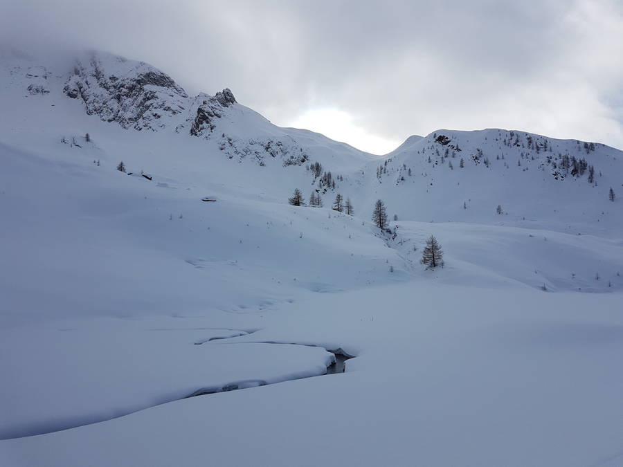
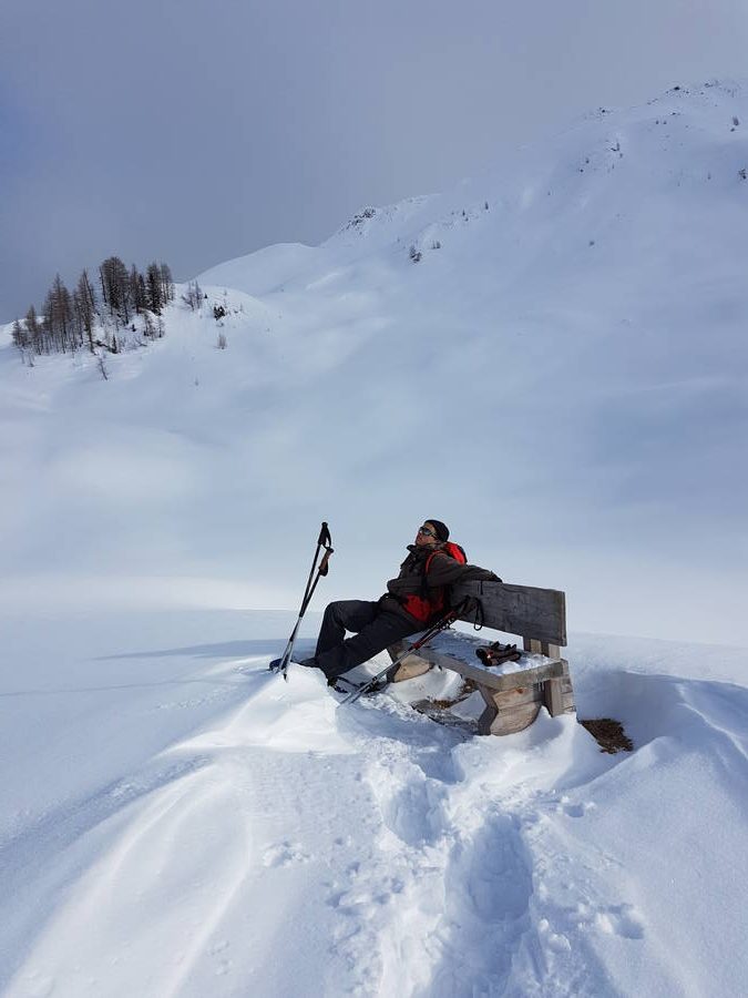
We took a break on a bench (!), simply available in the area, and confirmed with a small signpost (mostly buried in snow) that we were on the right track, trail 20A, terminus Eggespitz. Briefly we took a vote on whether to continue – it was well past 3 pm and purple snow-laden clouds travelled from the north-east towards us, attracted by the magnetism of the high scraggly wall of the valley.
We set on timeboxing ourselves to half an hour, and sped on to climb the last 200 metres to the peak. Waist-deep snow or not, we kind of made it on time, just as the sun poked its rays through the thickening clouds one last time.
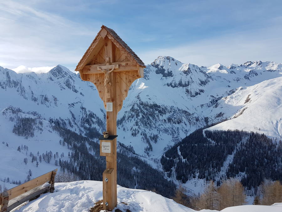
We celebrated for a minute and headed back down. Though short-lived, our stay on the top left us with a vivid memory, a sense of adventure, and many worthy images of the pristine snow fields and peaks, washed over by pastel winter light. The haze, the ice blocks, the stillness, the crunchy squeaking of fresh unyielding snow – hard to believe that lasted just 4 hours that stayed with me years later.
YOU MAY ALSO BE INTERESTED IN READING
A late winter story from the border of the German-Austrian border in the Alps