
To read about some easy yet secluded walking in the immediate vicinity of Amalfi, check out Part 1 here.
If you’ve looking for something a bit further afield and a bit more demanding, in Part 2 here I share one of the best hikes in the area, and maybe even the world. Despite being off-the-beaten path, you can get to the trail head within just a half-hour or so of driving. Also, if you’re looking for a day trip option, this trail can be done in a loop so that’s an additional benefit.
the real path of the gods in amalfi
You have probably heard of the famous Path of the Gods trail (Sentiero degli Dei) – a hiking trail from Agerola (specifically, the neighbourhood of Bomerano) all the way down to Nocelle, Montepertuso, and Positano (to reach its start take any fork from Strada statale 163 to Strada statale 366 towards Bomerano). As you can imagine, it’s a pretty touristy trail, with quite some human artefacts such as parking spots, paved places, and even a refreshment road-side stall or two.
It is nice, but if you’re looking to really enjoy the breathtaking views in the midst of nature, I would recommend taking the Old Path of the Gods (Sentiero alto degli Dei), a.k.a. trail #329.
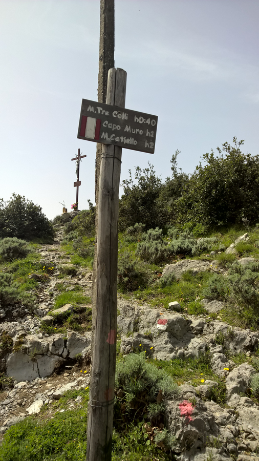
It also starts from Bomerano and runs above the well-known Path of the Gods (so I guess it’s in a sense the “Path of the Upper Gods”?). It is also known as the Circuit of Monte Tre Calli. You can either do a loop on it, or go down all the way to Positano – either way, prepare yourself for the views all the way through.
circuito tre calli – where to start the hike
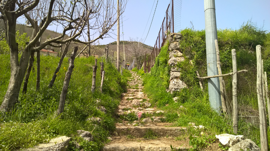
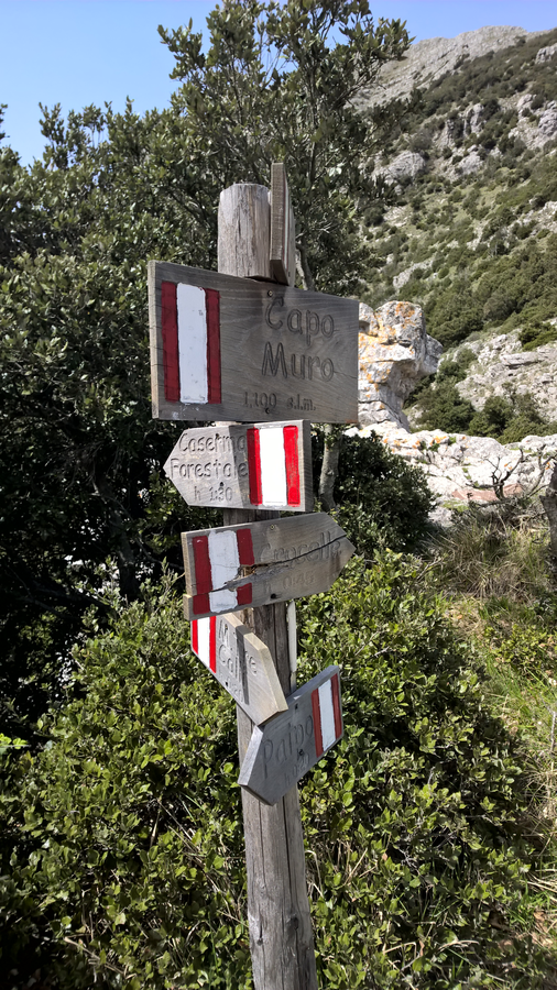
To reach the trail head look for information signs from the Bomerano square, near Hotel Gentile to get to the starting place on via Paipo. I’ve created a simple Google map showing directions to the trail head.

There’s also a big map there at the trail head showing also other trails shown in the area that you may want to explore (see photo below).

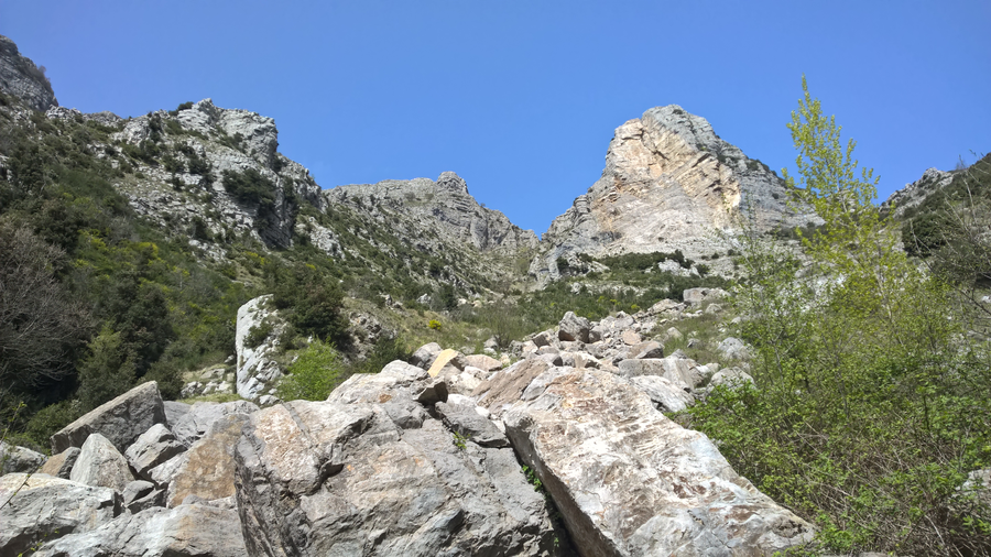
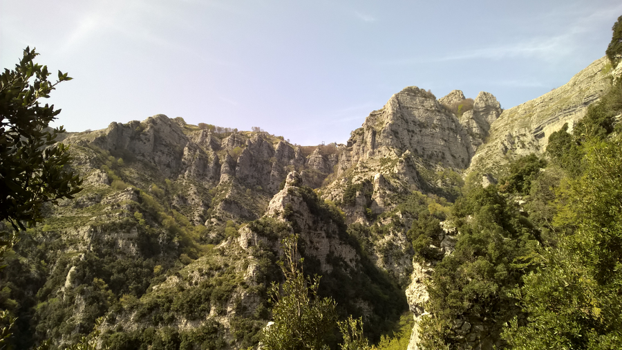
If you’re looking for a short and leisurely day hike you can take either of the forks #329 or #329c (the street via Paipo), and upon reaching their meeting point (just under the towering wall of Capo Muro on you right-hand side), take the other fork to finish a small loop. Here is a map from the Itailan Alpine Union (CAI) that may come in handy to visualise the trail.

I recommend taking 329 on the way up and 329c on the way back down – the latter follows via Paipo, a sunny road that I’d prefer to be descending on it rather than climbing up (-:. There’s a short stretch of sunny uphill road until you get to #329 but then you enter the forest pretty fast where you can find some cool and shade.
circuito tre calli – the details
The first half hour up is somewhat steep but without any exposure, so safe for vertigo-prone people (like myself). However, it can get pretty hot even in April, so do bring along at least a couple of litres of water per person to stay well hydrated. There are no streams or any water source at all along this hiking trail.
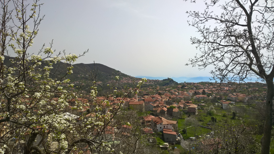
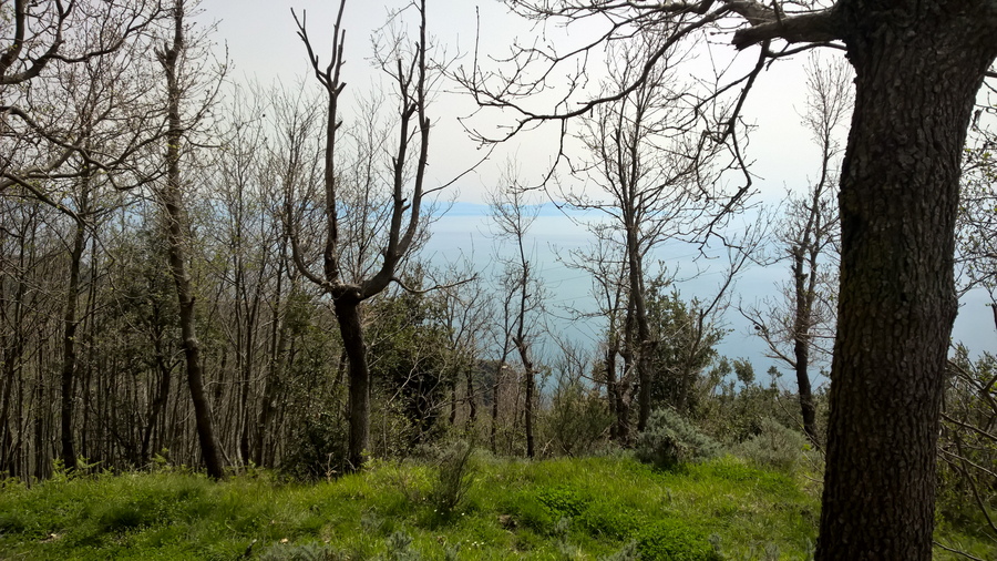
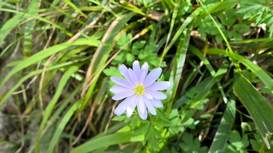
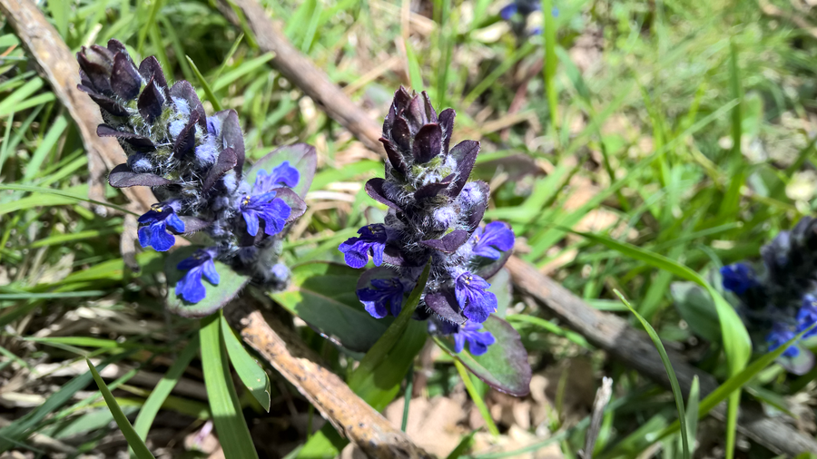
We went in mid-April, so the forest wasn’t as leafy and shady. However, the beautiful blossoming fruit trees in the area more than compensated for the meagre shade. If you happen to be a fan of flowering trees, or enjoy cherry blossom viewings (hanami), then early April would be a great time to go.
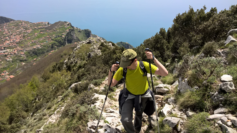
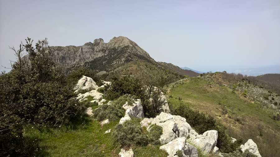
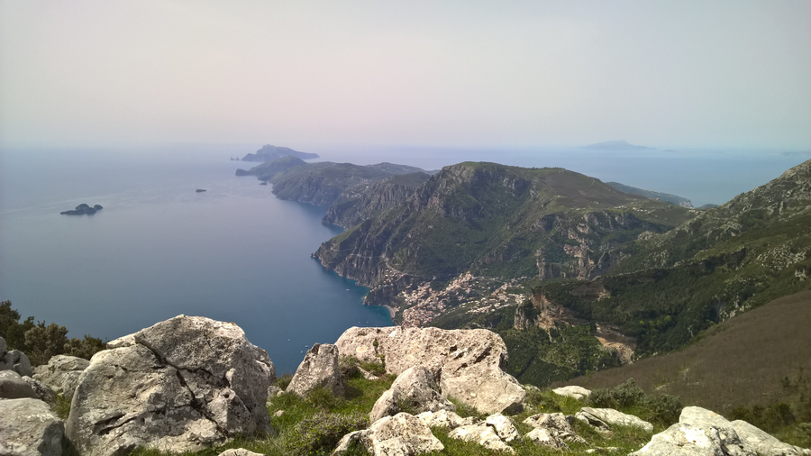
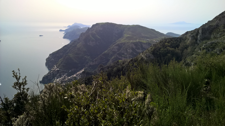
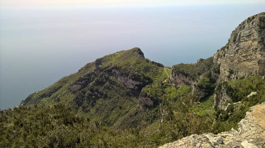
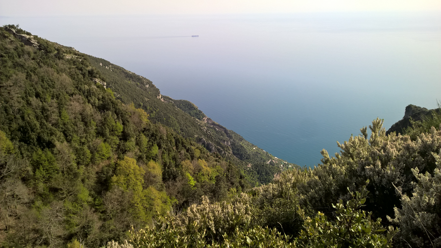
After this first ascent you emerge at the best reward ever – magnificent 360 degree(!) views of the Sorrento coast. The spot is a sort of small terraced nose strewn with white stones, perfect for a break and some snacks!

You can expect to complete the loop trail about 3-4 hours, depending on the weather conditions and your speed (for example, whether you’re taking photo or food/rest breaks). No need to rush – the views are mesmerising and well worth wandering around.


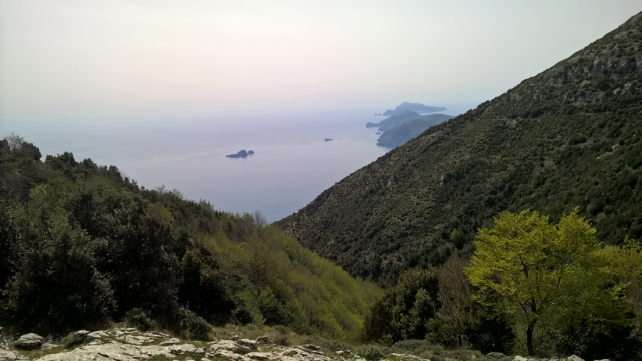
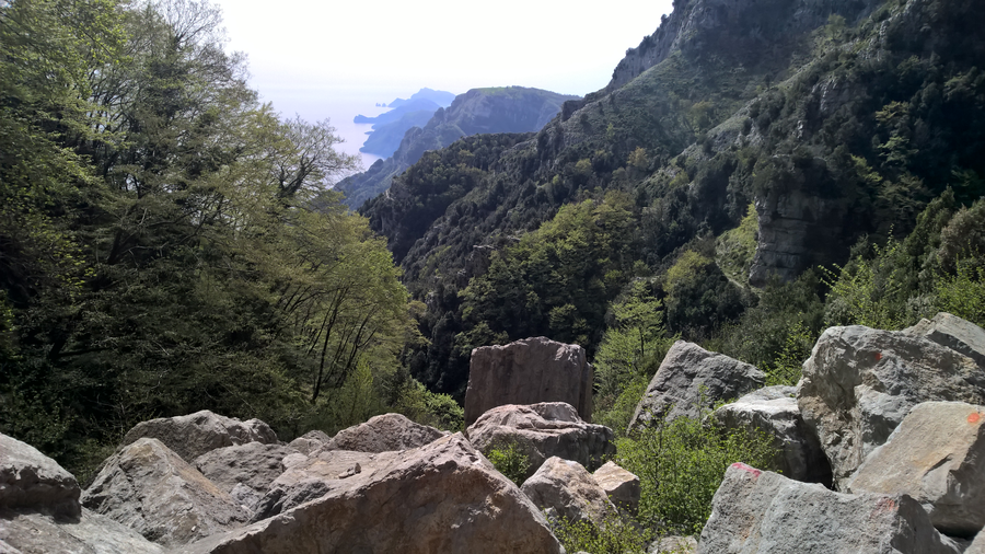
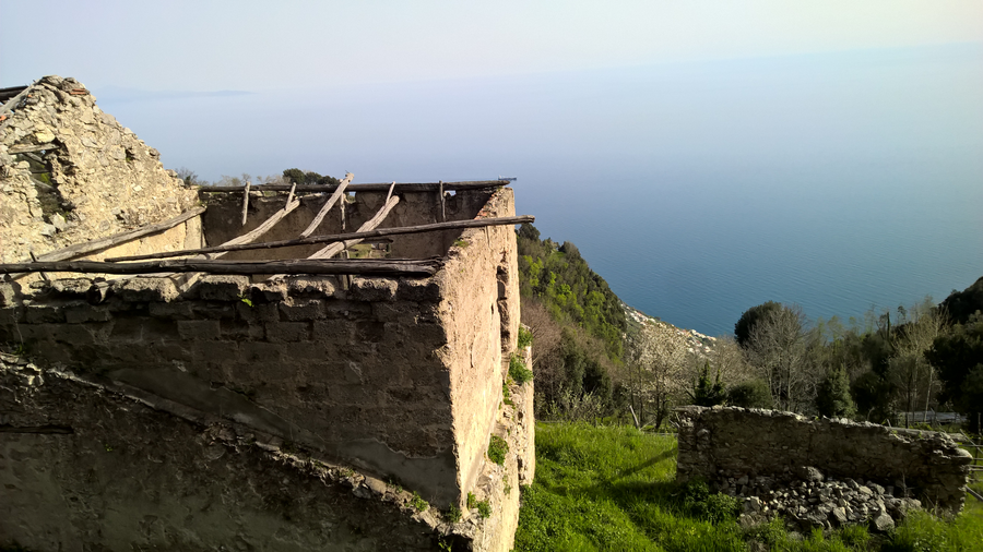
We started from our hotel around 11 am, started the trail around noon, and walked at our pace for about 4 hours. In this time we did the loop trail plus a stretch after Capo Muro until the middle point to Caserma Forestale, where we came across the remnants of a landslide. Surreally giant boulders had obliterated the trail, but opened a surreptitious and very satisfying peek towards the coast – just beautiful.

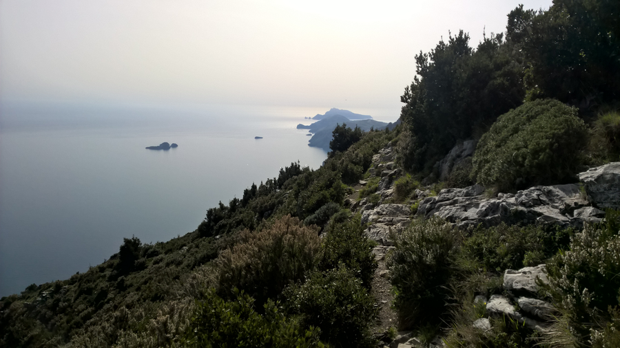
We were returning on this trail around golden hour, around 4 pm in the afternoon, and the light descending over the calm Tyrrhenian sea and the terraced landscape was amazing.

super long or short options
If you have more time, don’t hesitate to continue all the way to Positano – the landslide can be easily crossed from stone to stone, and it’s not indicated as current landslide risk or anything. To do the whole trail you should start early in the morning to make sure you have plenty of time.
Also, make sure to arrange transport back to Bomerano – while possible to go both ways in a single day, it would be exhausting and not really worth it (unless you’re training for something, or it’s just your style).

Alternatively, you can climb just the initial stretch for a wonderful secluded and/or romantic picnic on the small terrace just after the ascent. Just make sure to bring warm clothes, and pick a day with no rain on the forecast.
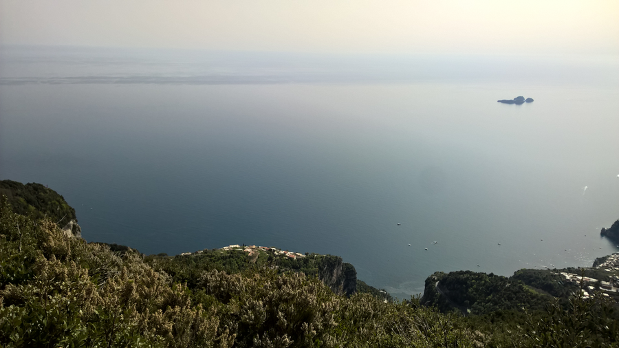
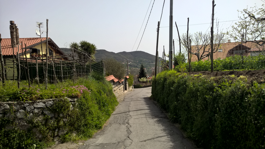
I captured some great purple views as we descended along the via Paipo fork on the paved road. Some picturesque old houses act as great juxtapositions to the seaviews in the background.


transport & parking
As far as I know, there is only a bus to Agerola, so if you go with the public transport, you would have to walk about 1 km/mile up to Bomerano.
For people travelling by car, note that you should park in Bomerano, as there is no parking on via Paipo to speak of. It’s sort of a private/access-restricted road as far as I could tell. Look for parking behind the village square, in the side streets. As long as you don’t obstruct the road you should be good.
When you park in Bomerano, you will still need to walk some 15 mins to the trail head (see my map with directions above). Look out for red painted strips indicating a hiking path on the walls of buildings etc.
what other people think of this trail
If you’d like to see what other people thought of this hike, you can find some first-hand experience reviews of it on Trip Advisor here.
Good luck, and let me how you enjoy this trail if you try it! Any questions, leave them here or connect with me via #snapographi on all social media.
P. S. One more trail in the area coming on the blog in Part 3 soon, stay tuned!
— Silvia
Hello ,
I saw your tweets and thought I will check your website. Have to say it looks very good!
I’m also interested in this topic and have recently started my journey as young entrepreneur.
I’m also looking for the ways on how to promote my website. I have tried AdSense and Facebok Ads, however it is getting very expensive. Was thinking about starting using analytics. Do you recommend it?
Can you recommend something what works best for you?
I also want to improve SEO of my website. Would appreciate, if you can have a quick look at my website and give me an advice what I should improve: http://janzac.com/
(Recently I have added a new page about FutureNet and the way how users can make money on this social networking portal.)
I wanted to subscribe to your newsletter, but I couldn’t find it. Do you have it?
Hope to hear from you soon.
P.S.
Maybe I will add link to your website on my website and you will add link to my website on your website? It will improve SEO of our websites, right? What do you think?
Regards
Jan Zac
Hi Jan,
Thanks for your comment.
To be honest, I am still learning myself – there’s lots of great info out there on the Internet.
You’re probably better off searching for your specific situation.
Good luck!